How can we make the Central Oxfordshire Travel Plan work for Morrell Avenue?

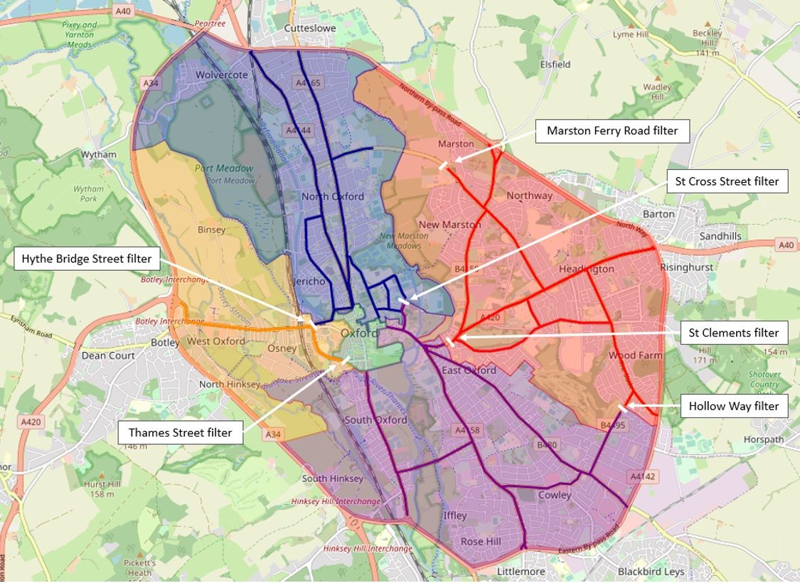
Two keys aim of the Central Oxfordshire Travel Plan (COTP) traffic filter scheme are to:
- prevent private motor traffic destined for Headington (particularly the hospitals) cutting through Cowley, Iffley, East Oxford and St Clement’s; and
- reduce pollution levels on St Clement’s Street, which is the most polluted road in Oxford.
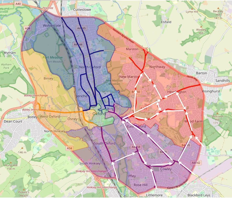
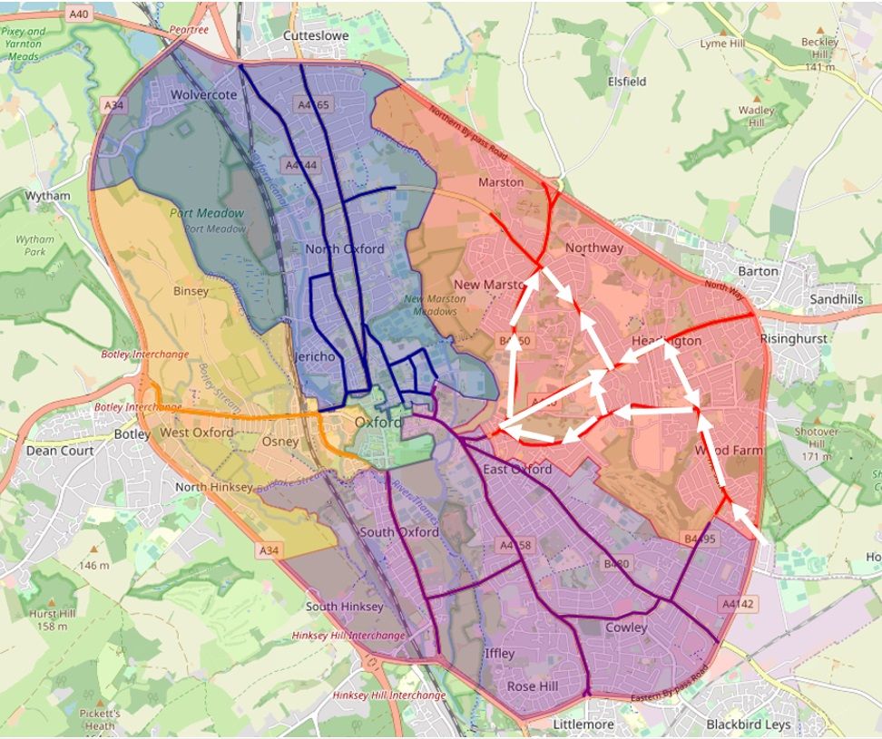
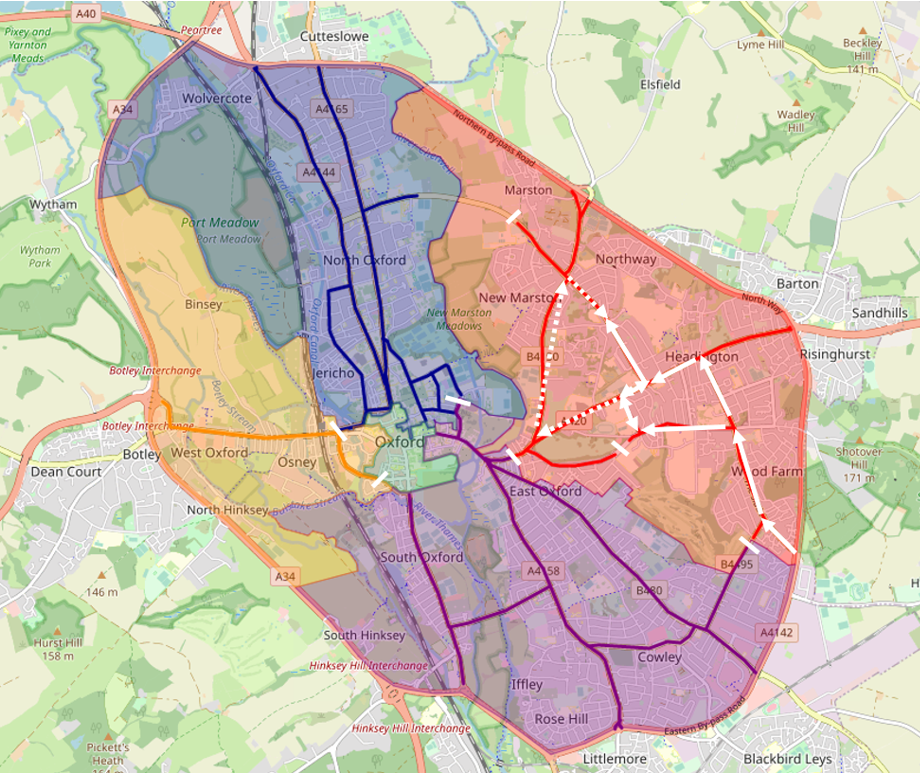
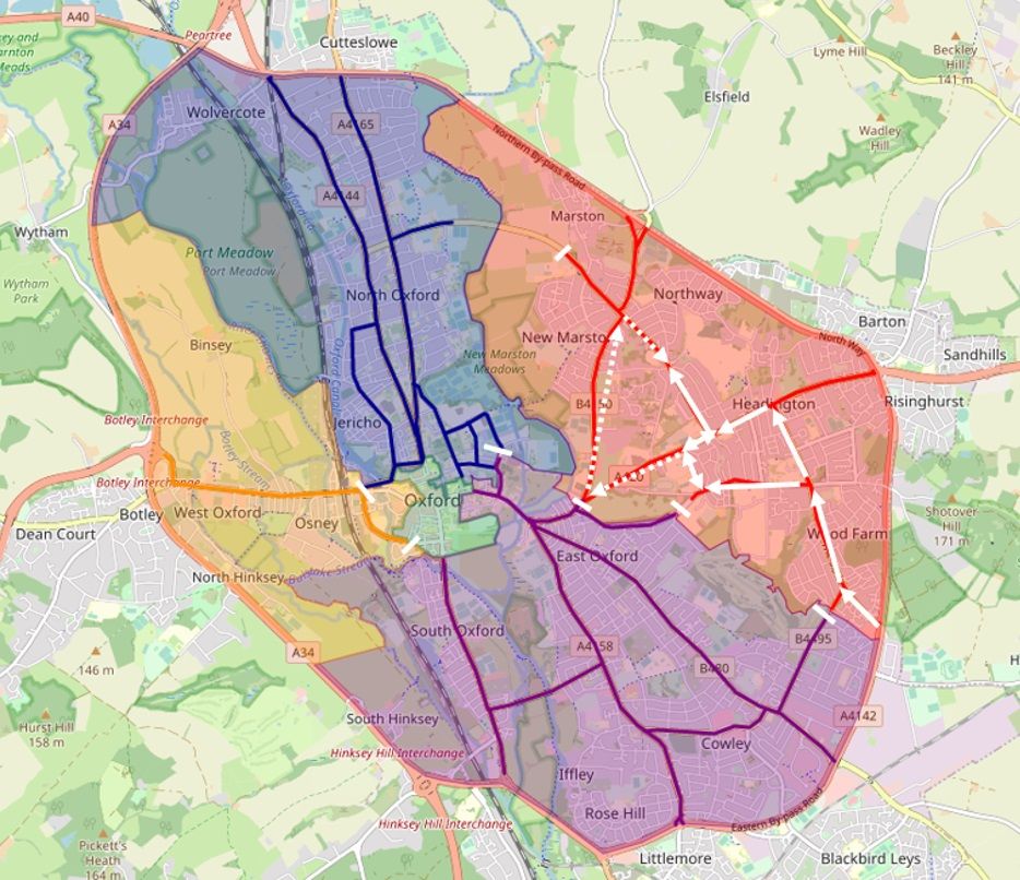
The map below shows the current main road routes to Headington through Cowley, Iffley, East Oxford and St Clement’s, as indicated with arrows:
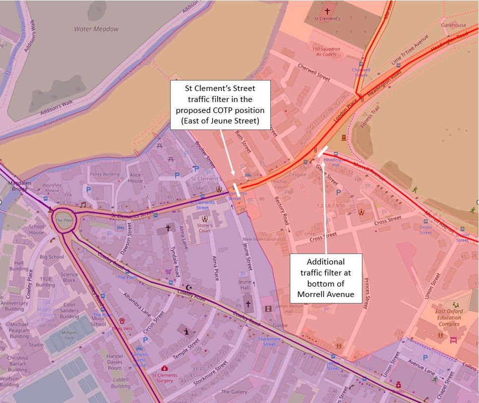
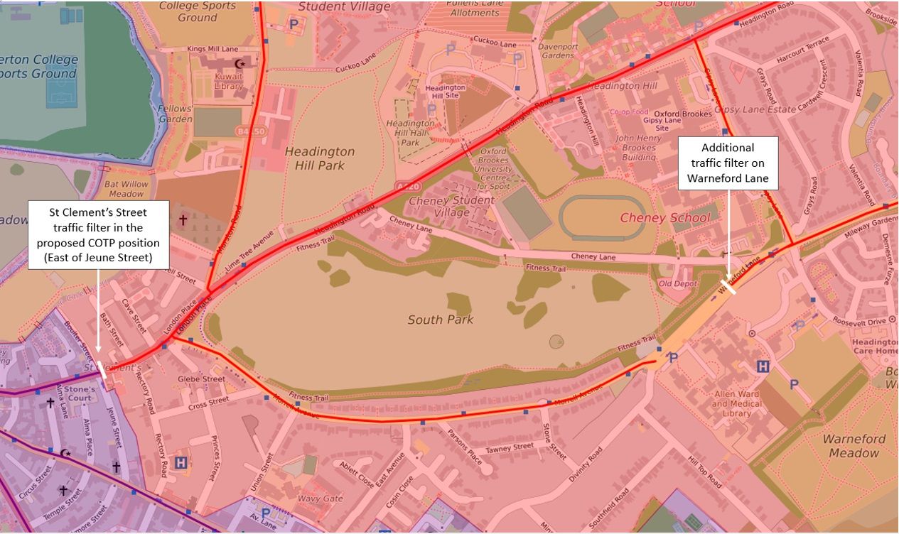
The Council’s traffic filter plans always included a filter on Hollow Way, but the Council has added a filter on St Clement’s to stop drivers travelling between East Oxford and Headington/Marston via St Clement’s Street, as shown below:
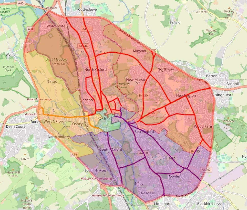
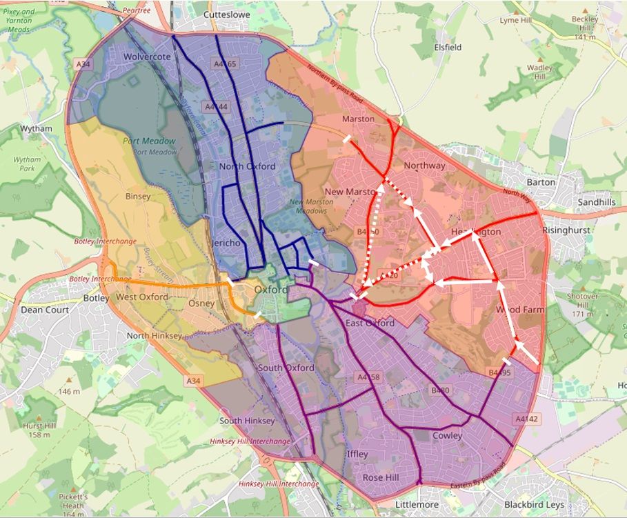
The traffic filters on Hollow Way and St Clement’s do achieve the aims described above, but because the St Clement’s filter is placed to the West of Morrell Avenue, it does not prevent an Old Road – Morrell Avenue – St Clement’s route to the hospitals, so there is a risk that traffic volumes will increase on Morrell Avenue, using the routes as shown below:
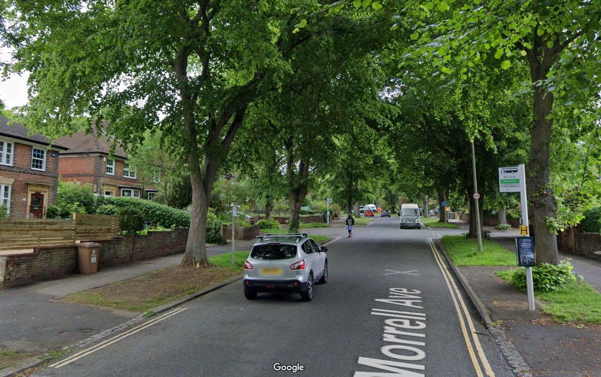
This could be particularly problematic for Morrell Avenue, a residential road that isn’t suitable for high traffic volumes.
Morrell Avenue has suffered from speeding through-traffic for many years and the road can be difficult to cross due to the volume and speed of traffic and lack of pedestrian crossings.
Before the on-street parking was removed as part of the recent Quickway installation, cars parked on the road made it dangerous for cyclists as they were pushed into the path of motor vehicles whilst dodging parked cars, and added to the challenges of crossing the road as it could be difficult to see approaching cars and cyclists.
Morrell Avenue has had mixed fortunes recently:
- following installation of the Divinity Road area low-traffic neighbourhood, Morrell Avenue has received more traffic, at least at rush-hour, as some drivers who can no longer use Divinity Road to get between Headington and Cowley Road have switched to using Morrell Avenue instead;
- the installation of a ‘Quickway’, which involved removing all parking spaces from Morrell Avenue and painting cycle path lines on, has made it:
- safer and easier to cycle on, as cyclists no longer have to weave around parked cars and they are more visible to other roads users;
- easier to drive buses on, without having to pull out to avoid parked cars or being delayed behind parked cars while waiting for oncoming traffic to pass;
- possibly easier and safer for pedestrians to cross the road, as they can see approaching cars and cyclists more easily and drivers and cyclists can see pedestrians more easily;
but
- these measures have not solved the problem of speeding traffic (except during peak-time congestion);
- there are still no pedestrian crossings, except for the one zebra crossing at the top, which is of no use to anyone who needs to cross lower down the road;
- some residents weren’t happy about losing on-street parking.
And now with the COTP traffic filters, Morrell Avenue may receive even more traffic.
Oxfordshire Liveable Streets foresaw this problem back in 2020 and proposed 2 additional traffic filters on Warneford Lane and London Place on St Clement’s Street as explained in this Oxfordshire Liveable Streets article and explainer video. (Back then COTP was called ‘Connecting Oxford’, traffic filters were called ‘bus gates’ and there were only 5 proposed bus gates, so Oxfordshire Liveable Streets coined the phrase ‘Connecting Oxford Plus’ for their idea for the 2 additional bus gates.).
There are a few options for addressing these problems for Morrell Avenue, including the Connecting Oxford Plus suggestion, which are explained below.
Option 1
Adding a traffic filter at the bottom of Morrell Avenue, with the St Clement’s Street traffic filter in its current proposed position:
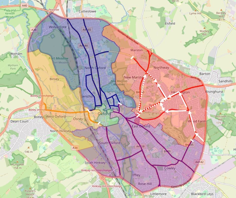
This would stop Morrell Avenue being used as a cut-through route and would have the effect of reducing the Headington destination routes from the South as shown below (the route shown with dotted arrows would still be available but would involve more distance and is unlikely to be quicker):
Effects of option 1:
- Most private motor traffic would be removed from Morrell Avenue – it would become a low-traffic road as the only reason to drive on it would be to access houses on Morrell Avenue or the adjoining roads.
- Morrell Avenue would remain in the East zone.
- Residents and their visitors could only exit Oxford via Warneford Lane to the East, whereas under the Council’s current plans they can also exit via Headington Road and Marston Road.
Option 2
Adding a traffic filter on Warneford Lane, with the St Clement’s Street traffic filter in its current proposed position, as shown below:
This would produce the same traffic-reducing effect on Morrell Avenue as option 1, as shown below:
The Council originally intended to put a traffic filter on Warneford Lane and received Active Travel Funding from central government to do that, but decided not to proceed with it for reasons that are unclear, although we understand that it was strongly opposed by some local councillors.
Effects of option 2:
- Most private motor traffic would be removed from Morrell Avenue – it would become a low-traffic road as the only reason to drive on it would be to access houses on Morrell Avenue or the adjoining roads.
- Morrell Avenue would remain in the East zone.
- Residents and their visitors could only exit Oxford via Headington Road or Marston Road, whereas under the Council’s current plans they can also exit via Warneford Lane.
Option 3
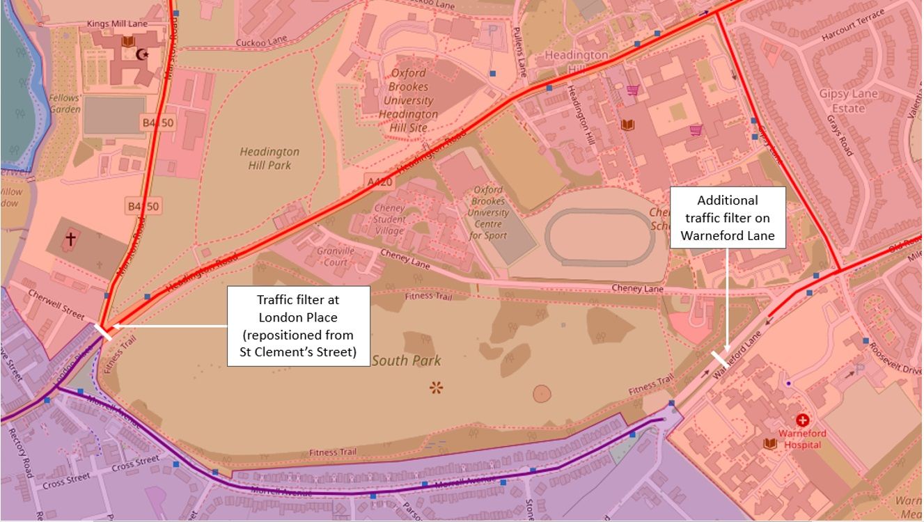
Adding a filter to the bottom of Morrell Avenue and re-positioning the St Clement’s filter to London Place, as shown below:
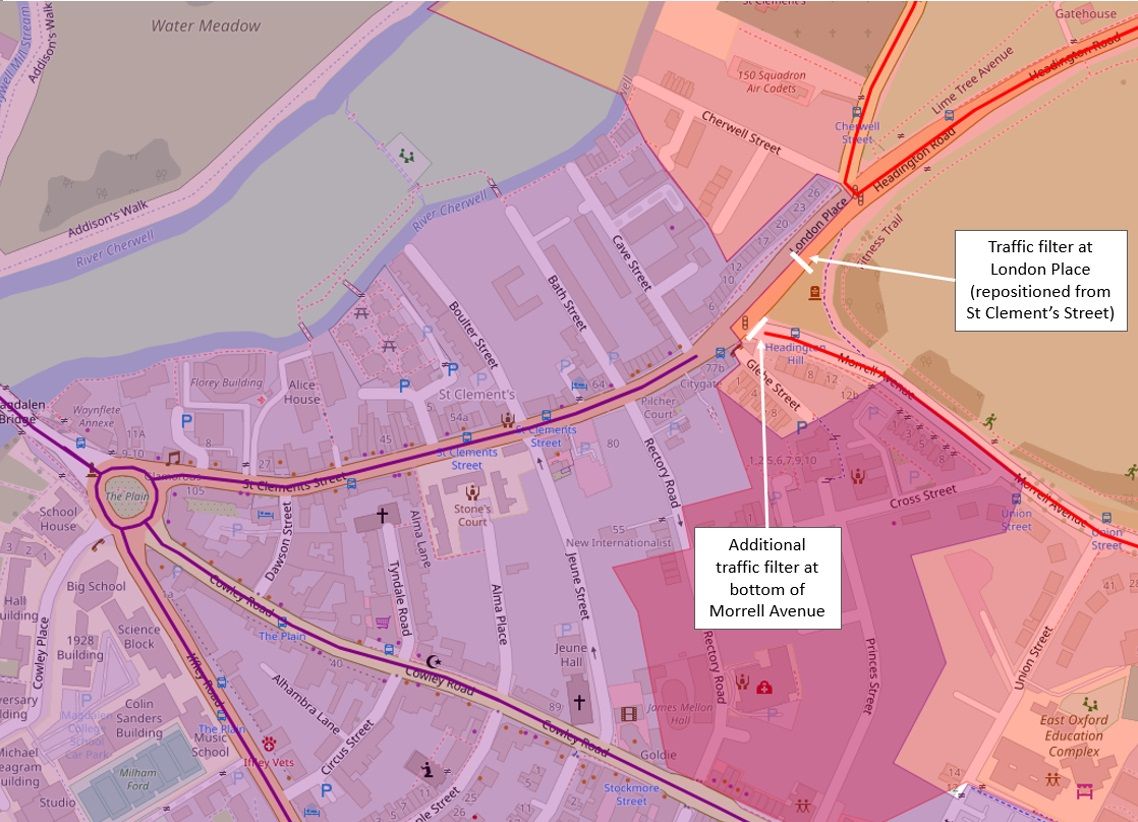
This would produce the same traffic-reducing effect on Morrell Avenue as options 1 and 2, as shown below:
Effects of option 3:
- Most private motor traffic would be removed from Morrell Avenue – it would become a low-traffic road as the only reason to drive on it would be to access houses on Morrell Avenue or the adjoining roads.
- Morrell Avenue would remain in the East zone.
- Residents and their visitors could only exit Oxford via Warneford Lane to the East, whereas under the Council’s current plans they can also exit via Headington Road and Marston Road.
Option 4
Adding a traffic filter on Warneford Lane and re-positioning the St Clement’s filter to London Place, as shown below:
This would produce the same traffic-reducing effect on Morrell Avenue as options 1, 2 and 3, as shown below:
Effects of option 4:
- Most private motor traffic would be removed from Morrell Avenue – it would become a low-traffic road as the only reason to drive on it would be to access houses on Morrell Avenue or the adjoining roads.
- Morrell Avenue would be in the South zone.
- Residents and their visitors could only exit Oxford via Cowley Road, Iffley Road or Abingdon Road to the South, whereas under the Council’s current plans they can also exit via Warneford Lane, Headington Road and Marston Road.
Summary
Because Morrell Avenue is on a bus route, if residents want to be protected from a continuation of current traffic levels and a potential increase in traffic volume due to the effects of the COTP traffic filters (and Divinity Road area low-traffic neighbourhood), an additional traffic filter is the only option.
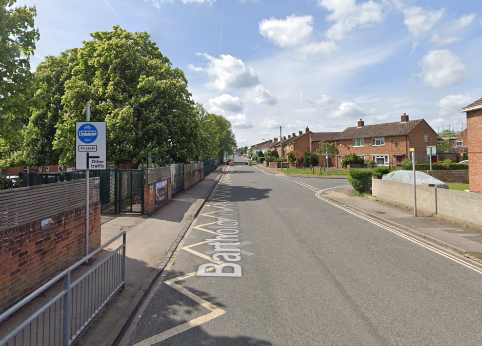
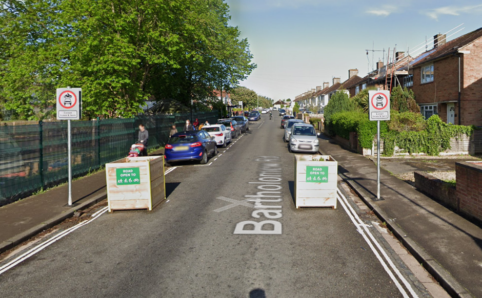
This measure was used on roads that are on bus routes in the Cowley LTNs, with ANPR-enforced traffic filters that allow buses through being installed on Cornwallis Road in Florence Park and Bartholomew Road in Church Cowley.
A traffic filter could protect Morrell Avenue from through-traffic, making it much safer, quieter, easier to cross and generally more pleasant and sociable, much to the benefit of residents and their visitors and everyone who travels on it other than by private car.
A traffic filter would also restrict the routes residents and their visitors can take to and from Morrell Avenue and its adjoining roads by private car.
However, those restrictions would not restrict blue badge holders, people who travel by bus, walking, cycling, using a wheelchair, mobility scooter or other scooter. It’s worth remembering that for these categories of people, the traffic filter positions and the zones they create have no negative impact, only positive improvements.
As such, residents of Morrell Avenue and its adjoining roads will need to decide whether the benefits of having a low-traffic road (safer, quieter, uncongested, more sociable) are worth the restrictions on their car use, and if so:
- whether, for the purposes of getting around by private car, they want to be within the East zone (with Headington) or the South zone (with East Oxford); and
- which roads they would prefer to use to exit Oxford.
If you’re affected by the traffic problems on Morrell Avenue, please do respond to the Council’s consultation on its proposals for 6 ANPR-enforced traffic filters in Oxford, and ask for an additional traffic filter to protect Morrell Avenue, stating your preferred option for the positioning of the traffic filter.
Related articles